 Introducing 3D Laser Scanner P40 In India. Please visit
DGPS Survey
Galaxy Geomatics provides solutions and systems for positioning, surveying, mapping, navigation, cadastral, building and construction, photogrammetry, mining and engineering, and other surveying and measurement applications. Measuring systems include high precision GPS, Total Stations, Theodolites, Levels, GIS, Software and Hand Held measurement devices.
- DGPS Survey, Entire East & West Coast for NRSC
- DGPS Survey using Cartosat Imagery for Tea Board
- Establishment of Control Points across Madhya Pradesh State, Commissioner Land Records , M.P
- GCP planning and data collection for Aerial Flying using DGPS at Nellore, TADA, Chennai, Mumbai.
- 100+ projects since 2003
RTK (Real time Kinematic)
This is the most used type of survey using DGPS. In this the corrections will be real time and the user can see the corrected values of coordinates instantly.
Further , there is no need of processing the data in office and can be directly used for field applications.
It provides a positional accuracy of around 2 cm which suffices for most of the construction industry.
This can be done either with the help of Radio (which is banned in India ) or by the help of a server setup.
Galaxy Geomatics has a server set up , which can cater to recording of points for up to 50 km from the base station.
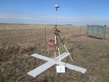
Static Survey
This is used for setting up of control points and bench marks . in this technique, the GPS receiver is set up over a point for about 45 minutes to an hour. We can achieve an accuracy of 1 mm with this technique. This is mainly used to setup the control network. Galaxy geomatics has successfully set up the control network for Kurnool city master planning project with this technique – Client – Feed back infraPPK(Post processing Kinematic)
In this method , the survey is done with out the use of either the radio or server. The data has an accuracy of about 2 to 3 meters, and, when the data is processed in software like Trimble business center, we get accuracy to the level of 2 cm.
Applications in Infrastructure industry.
Road survey
DGPS is mainly used to set up Permanent bench marks at every 5 kms and temporary bench marks at every 250m. Further, it can also be used to record all the features of the road like road furniture, utilities etc. Once the design is done based on the survey data, DGPS can also be used to stake out center line of the road and any other entities on knowing their coordinates. It is rapidly replacing the traditional total station as work can be done many times faster-
Apart from these DGPS is also being used in the following sectors
- Building survey
- Area survey
- Contour survey for dams
- Canal survey
- Pipeline survey
- Solar panel setup survey
- Drone control points survey etc..